Locations are described informally
Directions depend on names, landmarks, or memory rather than a consistent location record.
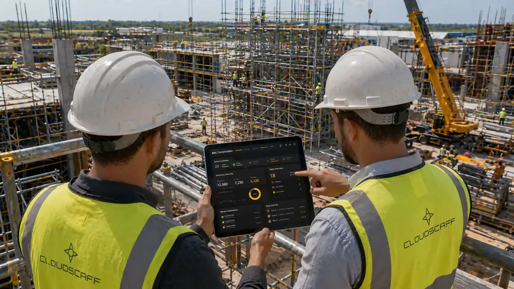
Site Location Tracking
Use GPS-enabled devices to locate scaffold records accurately, support site coordination, and reduce confusion across large or complex worksites.
Location context for scaffold records, inspections, and site coordination
The Problem
On large sites, a scaffold reference alone may not tell teams where to go. Without location context, inspections, handovers, and updates take longer.
Directions depend on names, landmarks, or memory rather than a consistent location record.
Multiple scaffold areas can look similar, increasing the risk of visiting or updating the wrong record.
Teams need clearer location data for coordination, inspections, and urgent site actions.
If a scaffold cannot be found quickly, every site action takes longer.
The Solution
CloudScaff adds geolocation to scaffold records so teams can pinpoint where structures are and coordinate work from clearer site context.
Use GPS-enabled devices to add location context to scaffold records.
Help teams find the correct scaffold for inspection, handover, update, or dismantle activity.
Use location context for planning, emergency response, customer queries, and site communication.
How It Works
Location is captured as part of the scaffold record, then used to support inspections, handovers, updates, and closeout.
Start from the scaffold, site, or register record that needs location context.
Use a GPS-enabled device to pinpoint the scaffold position.
Support inspections, handovers, updates, and dismantles with clearer location data.
Use location context to guide teams back to the correct scaffold record.
Included Controls
Use GPS-enabled location capture so scaffold records carry clearer site position context for field teams and managers.
Pinpoint scaffold locations on site for operations, planning, and emergency coordination.
Outcomes
Geolocation helps teams find, inspect, update, and discuss the right scaffold with more confidence.
Use location context instead of informal directions.
Match physical scaffold locations to digital records more clearly.
Give supervisors and teams a clearer view of where work is happening.
Use location context during inspections, incidents, and urgent follow-up.
FAQ
Geolocation FAQ
Map Site Activity
Use geolocation to help teams find and manage scaffold records on active sites.